Explore Collections Explore The Collections
You are here: CollectionsOnline  /  Drawings

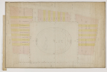
Finsbury Square, Islington, London, 1783 and 1789 (2)

Finsbury Square was the key part of a larger development by the City of London, most of the surviving drawings for which are in the Corporation of London Records Office. The Finsbury Estate occupied nearly all of the areas between London Wall and Old Street, from Whitecross Street to what is now Bishopgate Street. Much of it was outside the City, within the old borough of Finsbury and modern borough of Islington, and was held by the City on a long lease for development from 1768 - the year in which the younger George Dance succeeded his father as Clerk of the City Works. Planning and development were to last the whole of Dance's career and beyond.

A number of projected schemes for the development of the Finsbury Estate were drawn up. The earliest scheme is of 1769, that is, before the establishment of the Finsbury Estate sub-committee on 21 March 1770, and covered a large area bounded by Chiswell Street and Middle Moorfields to the south, Bunhill Row to the west, Old Street to the north and The Curtain to the east. It was an ambitious design with three circuses, an elliptical circus, a crescent and various squares and streets as well as five markets for poultry, meat, fish, vegetable and undesignated, ornamental fountains and monuments (CLRO, Surveyor's City Lands Plan 1144). The unfinished plan is drawn in a type of oblique projection and is inscribed by an unidentified hand 'Finsbury Designs for buildings / made in 1769 / JP', suggesting that James Peacock, and not Dance, may have been the originator. A larger and even more complex scheme (CLRO, Surveyor's City Lands, 1146), roughly drawn out and with inscriptions by Peacock, includes the Artillery Ground and Lower Moorfields as well as the area covered in the previous plan and was made perhaps in the same year (Stroud dates it to c.1768 and reproduces it as fig.40).

Smaller schemes for parts of the Finsbury Estate included one of about 1774 for a new street between Bunhill Row/Brown Street and Whitecross Street with a crescent at the west end which was later modified, the crescent being omitted (CLRO, Comptroller's City Lands 50B). A scheme of 1777 proposed a plan with a crescent between two squares, the crescent on the site of what was later Finsbury Square (CLRO Comptroller's City Lands 248; Surveyor's City Lands Plan 1155). Both of these plans show a row of building lots on the east front of the Artilery Ground that was acquired by the City from the Artillery Company in 1775. This terrace was to become the west side of Finsbury Square, the other sides of the square proceeding from 1789. Finsbury Circus, designed on an elliptical plan, was not built until soon after Dance had left his post as architect to the City. It is seen on a drawing of January 1802 for a scheme 'between the Royal Exchange & Finsbury Square' and called there the 'London / Amphitheatre' (RIBA Drawings Collection, SD 142/6). There are a number of executed and unexecuted elevations for the Finsbury Estate in, for example, the CLRO, Surveyor's City Lands Plans Finsbury Portfolio (1161-1170).

At the Soane Museum there is a drawing with staffage made for Soane's Royal Academy Lecture XI, drawing No.87 ([SM 18/7/10]) showing the west side of Finsbury Square as executed (reproduced Stroud, fig.41a). First given on 16 March 1815, the lecture included Soane's comments on speculative building in which he compared Covent Garden, Lincoln's Inn Fields, Grosvenor Square and other developments, allowing that some recent schemes including Finsbury Square 'held out some prospect of a return to a better style of building' (quoted by Watkin, 1996, p.649).

Finsbury Square was redeveloped as tall, stoney-faced 'City Commercial' from 1904-05 and by 1945 only three of the original houses (on the earlier, west side) had survived World War II - and these have long since gone. The garden to the Square has lots its oval plan and distinction and is the site of a petrol filling station and an underground car park. The original houses of Finsbury Circus have all been replaced, since 1899, by office buildings including Lutyens's Britannic House, 1921-5.

LITERATURE. J. Nichols, Literary anecdotes, IX, 1815, pp.522-3; Stroud pp.124-40, figs 40-45; Kalman pp.203-06, 367-71 notes; D.Watkin, Sir John Soane: Enlightenment thought and the Royal Academy Lectures, Cambridge, 1996; B. Cherry and N. Pevsner, London 4: North, 1998, pp.639-40.

OTHER SOURCES. Soane Museum, Dance file, manuscript notes with photographs of some CLRO drawings. Also at the Soane Museum is a Valuation / of the / Finsbury Estate / 1793 (SM, Soane Case 147) and The Finsbury Estate dated 8 March 1793 (SM, Soane Case, 146). Both relate to a survey commissioned from John Soane after the death of Bishop Christopher Wilson who had succeeded to the Prebend of Finsbury in 1745 and played an active part in the development of the estate until his death in 1792. Soane's Office Day Books show that the survey was made between October 1792 and March 1793. The manuscript valuation, which is concerned with leases, rent and values, covers 25 lots beginning with Lot No 1 / That part of the Estate which / is bounded East by Moorfields / North by Chiswell Street, West / by Finsbury Street and South / by Ropemakers Street and ending with Lot No 25 / Ground remaining unlet / Middle Moorfields. Leaseholders are listed and include, for example, the Reverend John Wesley and his two houses chapel, sheds and stables. There is an appendix headed Street Paving with lists of streets, square footage and cost. The Finsbury Estate contains copies of the survey plans of Lots 1 to 25. These are small block plans of each lot coloured up to show the location of individual plots and marked with the leaseholders' names.
Architectural & Other Drawings results view
Select list view result
Select thumbnail view result
Architectural & Other Drawings results view
Select list view result
Select thumbnail view result